3/22/07

Windmill Bight Park is on Route 330 approximately two kilometres east of Lumsden, NL. Running through the park’s 39 hectares is a productive salmon river, a trout river, a freshwater pond with a sandy beach for swimmers and a large sandy beach on it’s saltwater boundary. We offer 29 private sites and a large overflow area which includes 11 RV hook-ups. Several of the sites are positioned along the two rivers and are very popular with visitors. Each site has a picnic table and fire pit with firewood available at the park office. A dumping station is located in nearby Lumsden, and a public laundry and shower facilities are just 2km away.


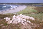
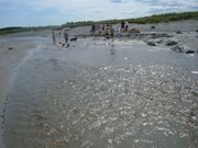
Windmill Bight Park’s day-use area has sandy, salt and freshwater beaches. Our warm, shallow freshwater pond is bordered on one side by picnic tables, private change rooms, and outhouses. Another side of the pond is bordered by a large sand dune, which has been washed up by the tides of the Atlantic Ocean.


This picturesque area has many historical attractions and traditional down-home Newfoundland & Labrador hospitality and culture. Some of our other favourite local attractions are:

-Barbour Living Heritage Village in nearby Newtown, New-Wes-Valley
-Random Passage Trail, Cape Freels
-Greenspond Courthouse (circa 1899), Greenspond
-Bonavista North Regional Museum, Wesleyville, New-Wes-Valley
-Banting Interpretation Centre, Musgrave Harbour


We’d also like to thank the Towns of Lumsden and New-Wes-Valley for their support and we encourage you to visit both on your journey through Bonavista North.


Environmental Highlights of the Windmill Bight Area:


The following data that we have accumulated regarding the environmental significance of our site come from publications and releases from the following organizations:

Sierra Legal Defence Fund
Protected Areas Association of Newfoundland and Labrador (PAA)
Natural History Society of Newfoundland and Labrador (NHS)
Canadian Parks and Wilderness Society (CPAWS)

“Windmill Bight Provincial Park on the rugged northeast coast of Newfoundland provides crucial protection for a rare sand dune system (1 of only 5 protected in the province), habitat for birds, fish, and other wildlife.”

Bill Montevecchi, a well known Newfoundland naturalist states, "There are more – many more – than 44 species of birds that use Windmill Bight Provincial Park as habitat. The site was protected as a provincial park in 1966 for good reasons, and those reasons are still there."


Eastern Hyper-Oceanic Barrens Eco-Region


The main portion of this ecoregion occurs on the extreme south coast of the Avalon and Burin Peninsulas, with two additional areas on the northeast coast near Bay de Verte and Cape Freels. Although this ecoregion is no more than 200m in elevation, the extreme oceanic climate prevents the development of forest other than balsam fir krummholz. Moss (Rhacomitrium) and crowberry (Empetrum) barrens in this area have a close affinity to oceanic parts of northern Scotland and southern Norway (W.J. Meades, 1983).

Presented throughout these pages is information which we have been able to gleen through local knowledge as well as through a cursory Internet search. Although brief, it does show that a vast array of flora and fauna can be seen within or near Windmill Bight and that the area exhibits interesting if not unique geological properties. Not only does it seem that we have a right to protect this resource we feel it to be a great shame that not more of our locals and tourists are given an opportunity to learn of our area’s great diversity. We also realize to assemble this data will require the services of a researcher capable of understanding the subject matter and working with government employees and environmental groups to unearth and interpret the vast amount of data.

Geology Of the Windmill Bight Area:


The area’s soils are of "organic fibrisols." These are soils that occur in peatlands and are composed mostly of organic matter.
Plateau bog are a type of bog that forms in coastal areas, where a build-up of sphagnum mosses 2 to 10 metres deep forms a plateau-like raised surface. Often this surface is scattered with large pools.
Tuckamore, also known as "krummholz", are areas where growth-limiting factors (such harsh weather and excessive moisture) have resulted in the stunted growth of trees.
The igneous intrusions (places where molten rock seeped up) are granite rocks formed about 350 million years ago during a time of great stress between the earth's tectonic plates.

Contact Us...

Windmill Bight Park Inc.
C/O Robert Boland
General Delivery
Pound Cove, NL A0G 3S0
Tel: (709) 530-2312
Off-Season: (709) 536-1347
E-mail: windmillbight@msn.com

Our Blog
www.windmillbightpark.blogspot.com
windmillbightpark@gmail.com

How to Find Us...


What's Your Favorite Part of Visiting Windmill Bight Park?